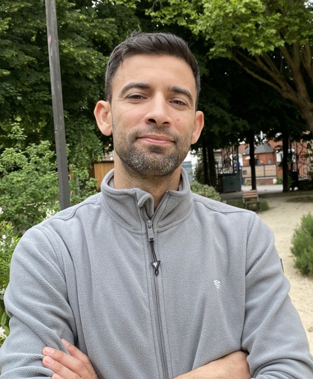
Vous êtes ici :
- Adresse : Site Chênes 2, 33 boulevard du Port, 95011 Cergy-Pontoise Cedex, France
- Télédétection et analyse spatiale
- Artificialisation et vulnérabilité environnementale
- Modélisation et méthodes d’apprentissage Machine
Discipline(s) enseignée(s)
Master Géomatique appliquée aux études urbaines et aux risques
M1 : Télédétection
M1 : Introduction en Bases de données
M1 : Initiation en programmation
M2 : Data Science & Dataviz
Master Développement culturel et valorisation des patrimoines
M1 : Cartographie et TIC
Licence de Géographie
L3 S5 : Approfondissement en Systèmes d’Information Géographique
L3 S6 : Télédétection
L1 S1 : Géographie régionale
Activités / CV
Parcours professionnel
- 2024 à présent:, Maitre de conférence en Géographie (CY, Cergy Paris Université)
- 2023-2024, Chargés d’études en géomatique (Laboratoire ACP-Université Gustave Eiffel)
- 2022-2023, Ingénieur de recherche en Géomatique/analyse de données –CNRS- (UMR IDEES Rouen)
- 2014-2022, Maitre de recherche en Télédétection (urbanisation/Risque) : Agence Spatiale Algérienne, Centre des Techniques Spatiales (Arzew, Algérie).
- 2012-2013, Stagiaire en Télédétection/analyse spatiale de l'urbanisation à Mayotte: IRD UMR Espace Dev (Maison de la Télédétection-Montpellier, Station SEAS-OI , La Réunion)
Diplômes
- 2019-2021, Habilitation universitaire : Monitoring spatial des zones humides littorales – Algérie, « ENSSMAL-Alger »
- 2014-2018, Doctorat en géographie et aménagement (environnement littoral), Ecole d’ingénieur « ENSSMAL-Alger »
- 2011-2013, Master en Géomatique (Université Montpellier2/Montpellier 3)
- 2006-2011, Ingénieur d’état en Aménagement du littoral Ecole d’ingénieur « ENSSMAL-Alger »
Corps
Informations complémentaires
Publications
Walid Rabehi, Marion Le Texier et Rémi Lemoy “data paper : An open-access urban footprint, France between 1750 and 1950: SUCHIES Historical database”, Nakala Plateforme https://nakala.fr/10.34847/nkl.aea7388x
Walid Rabehi et al. “Sandy beach mapping using deep learning approach, a potentiality for an automated monitoring of Algerian coast erosion”, Journal of Coastal Research (05/2023) https://doi.org/10.2112/JCOASTRES-D-22-00110.1
Bentekhici, N., Rabehi, W., Bouhlala, M.A. et al. Land cover changes mapping of the west-Algerian territory: a multiscale data analysis for the estimation of the sustainable goal 15.3.1. Environ Earth Sci 82, 428 (2023). https://doi.org/10.1007/s12665-023-11078-9
Walid Rabehi et al. Spatial Monitoring of Coastal Protection Dikes, Case Study of the Touristic Beach “Palm Beach, West Algiers, Algeria”, Book chapter – Springer proceeding (12/2022) DOI: 10.1007/978-3-031-16213-8_9
Soumia Bengoufa, Simona Niculescu, Mustapha Kamel Mihoubi, Rabah Belkessa, Ali Rami, Walid Rabehi, Katia Abbad, "Machine learning and shoreline monitoring using optical satellite images: case study of the Mostaganem shoreline, Algeria," J. Appl. Rem. Sens. 15(2) 026509 (3 May 2021) https://doi.org/10.1117/1.JRS.15.026509
Rabehi, W., Guerfi, M., Mahi, H. “ La baie d’Alger, un espace côtier prisé, Entre pressions d’urbanisation et gouvernance territoriale ” Volume 25 (2019) 141-158. journal ; Geo-Eco-Marina http://journal.geoecomar.ro/geo-eco-marina
Rabehi, W., Guerfi, M., Mahi, H. Rojas-Garcia, E. J “Spatiotemporal Monitoring of Coastal Urbanization Dynamics: Case Study of Algiers” Bay, Algeria” Indian Soc Remote Sens (2019) 47: 1917. https://doi.org/10.1007/s12524-019-01037-y
Otmani, H. Belkessa, R., Rabehi, W., Guerfi, M., “Dégradation des dunes côtières algéroises Entre pression de l’urbanisation et conséquences sur l’évolution de la ligne de rivage” Volume 25 (2019) 171-185. journal ; Geo-Eco-Marina
Communications
Walid Rabehi, Rémi Lemoy, Marion Le Texier. “Historical trajectory of large French cities over three centuries using radial profiles and scaling laws” séminaire “ECTQG 2023, Portugal”.
Walid Rabehi, Rémi Lemoy, Marion Le Texier. “Quick Mapping of historical urbanization in France, case study of Scan Histo 1950 using spatial pixel based approach”. séminaire GISRUK 2023 (Glasgow)
Walid Rabehi et al, W. Rabehi et al., "Monitoring And Estimation of The Sustainable Development Goal –Fifteen- By Remote Sensing Tools, Assessment of Change in Land Cover (Sub-Indicator 15.3.1), Case of Algeria," 2020 Mediterranean and Middle-East Geoscience and Remote Sensing Symposium (M2GARSS), Tunis, Tunisia, 2020, pp. 239-241, doi: 10.1109/M2GARSS47143.2020.9105157.
Walid Rabehi,., et al. “Quantifiying estuary landscapes and urban pressures using a remote sensing decision tree approach “. le Séminaire international « 21st Colloquium of Theoretical and Quatitative Geography (ECTQG), Luxembourg du 5 au 9 septembre 2019 »,
Autres implications
Expert en planification spatiale en zone maritime (UNESCO, Rapport MSP Global 2030, 02/2020).
Expert reviewer dans le rapport international du GIEC sur les changement climatique (2019, chapitre Océan et Cryosphére).
Expertise pour le rapport IMAP (Gestion intégrée de la zone côtière méditerranéenne, Initiative PNUE/PAM, 2018)
Mise à jour
S'il s'agit de votre fiche annuaire, vous pourrez mettre à jour vos informations une fois authentifié.
Se connecter


